cadmatix

CADMATIX ENGINEERING WORKS L.L.C: Precision-Driven CAD & Engineering Solutions Powering Modern Construction in the UAE

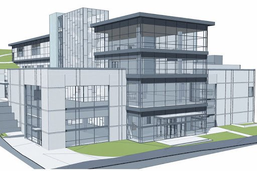
In today’s rapidly evolving construction and infrastructure landscape, precision is no longer optional—it is essential. Every successful project, whether residential, commercial, or industrial, begins with accurate technical planning, detailed architectural drawings, and reliable engineering solutions. This is where CADMATIX ENGINEERING WORKS L.L.C stands out as a trusted UAE-based engineering and design company committed to delivering excellence through advanced CAD services, architectural drafting, and energy-efficient building solutions. At CADMATIX ENGINEERING WORKS L.L.C, engineering is more than design—it is the foundation of successful project execution. By working closely with developers, consultants, architects, and construction professionals, the company ensures that every project is supported by technically accurate drawings, innovative solutions, and industry-compliant documentation. Why Precision Matters in Engineering and Construction The construction industry relies heavily on clear technical communication. A minor error in design or drafting can lead to project delays, budget overruns, compliance issues, or structural inefficiencies. That’s why precision in Computer-Aided Design (CAD) has become a critical component of modern engineering. CADMATIX understands that each line, measurement, and specification carries importance. Their services are built around delivering: Accurate CAD drafting Architectural drawings Geographical mapping Product design solutions Building visualization Energy-efficient design support By focusing on detail, clarity, and technical compliance, CADMATIX helps reduce project risks while improving operational efficiency for clients.Professional CAD Services Designed for Modern Projects Computer-Aided Design has transformed the way engineering and construction projects are planned. CADMATIX ENGINEERING WORKS L.L.C provides advanced CAD services that support everything from conceptual development to final project execution. Their CAD solutions help clients by: 1. Improving Design Accuracy Technical precision ensures every drawing reflects exact measurements and specifications, minimizing errors before construction begins. 2. Supporting Faster Project Delivery Detailed and organized CAD documentation allows teams to streamline approvals, revisions, and implementation. 3. Enhancing Collaboration Clear technical drawings improve communication between architects, engineers, contractors, and project managers. 4. Ensuring Industry Compliance Projects in the UAE require strict adherence to engineering and construction standards. CADMATIX prioritizes compliance in every stage of the design process. Architectural Drawings That Build Confidence Architectural drawings are the blueprint of every successful building project. Whether for residential developments, commercial properties, or industrial facilities, CADMATIX delivers architectural plans that balance functionality, compliance, and innovation. Their expertise includes: Floor plans Elevation drawings Section drawings Site layouts Interior technical plans Construction detailing These solutions empower clients to visualize projects clearly while ensuring construction teams have the technical guidance needed for accurate implementation. Energy-Efficient Building Solutions for Sustainable Development As sustainability becomes a global priority, energy-efficient design is increasingly shaping the future of engineering. CADMATIX recognizes the importance of integrating environmentally responsible strategies into technical planning. Their energy-efficient building solutions focus on: Optimized building layouts Sustainable material planning Reduced energy consumption Efficient system integration Smart design recommendations By supporting sustainable engineering practices, CADMATIX not only contributes to environmental responsibility but also helps clients reduce long-term operational costs. Geographical Mapping and Product Design Expertise Beyond construction drawings, CADMATIX also offers specialized technical services in geographical mapping and product design. These solutions are valuable for industries requiring advanced planning, technical analysis, and visualization. Geographical Mapping: Precise mapping services support land development, infrastructure planning, and spatial analysis. Product Design: Technical product development services help transform ideas into practical, functional, and production-ready designs. This broader engineering capability makes CADMATIX a versatile technical partner across multiple industries. A Client-Focused Approach to Engineering Excellence One of CADMATIX ENGINEERING WORKS L.L.C’s strongest advantages is its collaborative approach. The company works directly with: Developers Architects Consultants Construction firms Design professionals By understanding client-specific project goals, timelines, and technical requirements, CADMATIX ensures every service adds measurable value. Their commitment is not simply to deliver drawings—but to support project success through technical reliability. Why Businesses Choose CADMATIX ENGINEERING WORKS L.L.C In a competitive engineering environment, businesses need partners they can trust. CADMATIX stands out because of its: Precision: Every detail matters, and accuracy remains a top priority. Professionalism: Industry-standard processes ensure quality and consistency. Compliance: Technical outputs align with regulatory and engineering standards. Innovation: Modern CAD tools and design strategies improve project outcomes. Reliability: Clients receive dependable support from concept to completion. Building the Future with CADMATIX Engineering and design are at the core of modern development, and CADMATIX ENGINEERING WORKS L.L.C continues to position itself as a dependable force in the UAE’s technical services sector. Through professional CAD solutions, architectural drafting, energy-efficient strategies, and technical precision, the company helps shape projects that are efficient, compliant, and future-ready. For businesses seeking accurate engineering support, CADMATIX represents more than a service provider—it is a strategic technical partner dedicated to transforming ideas into successful realities. When precision, compliance, and technical excellence matter, CADMATIX ENGINEERING WORKS L.L.C delivers.


Meeting UAE and International Energy Efficiency Standards

Energy efficiency standards play a critical role in shaping modern construction practices. Compliance with both local and international standards ensures that buildings are safe, sustainable, and economically viable. Understanding Energy Efficiency Regulations Energy regulations define minimum performance requirements for building systems. These standards guide design decisions related to insulation, cooling, lighting, and energy consumption. Aligning Design with Compliance Requirements Energy efficiency services ensure that building designs meet regulatory benchmarks from the early stages. This reduces approval delays and compliance risks. Supporting Sustainable Development Goals Compliance with energy standards supports national sustainability initiatives and global environmental objectives. Improving Market Acceptance Buildings that meet recognized energy standards are more attractive to investors, tenants, and regulatory authorities. Conclusion Meeting energy efficiency standards is essential for successful modern developments. Professional energy efficiency services ensure compliance, performance, and long-term value.

Retrofitting Existing Buildings for Better Energy Performance

Not all buildings are designed with modern energy efficiency standards in mind. Retrofitting existing buildings offers an effective way to improve energy performance without the need for complete reconstruction. Understanding Building Energy Audits The retrofit process begins with an energy audit that evaluates current building performance. This assessment identifies energy losses, inefficient systems, and improvement opportunities. Targeted Efficiency Improvements Retrofit solutions may include upgrading insulation, replacing outdated HVAC systems, improving lighting efficiency, and optimizing ventilation. These targeted improvements deliver measurable energy savings with minimal disruption. Enhancing Occupant Comfort Retrofitting improves temperature stability, air quality, and lighting conditions, enhancing occupant satisfaction and productivity. Extending Building Lifespan Energy retrofits reduce stress on building systems, extending their operational lifespan and reducing long-term maintenance costs. Conclusion Energy retrofitting transforms underperforming buildings into efficient, comfortable spaces. It is a practical and cost-effective approach to meeting modern energy standards and reducing operational expenses.

Energy Modeling and Performance Analysis for Commercial Buildings

Energy modeling is a powerful tool used to predict how a building will perform before it is constructed or renovated. For commercial buildings, where energy consumption is high, performance analysis helps developers make informed design decisions that reduce long-term costs and improve sustainability. What Is Energy Modeling Energy modeling involves creating a digital simulation of a building’s energy behavior. This model considers factors such as building orientation, materials, occupancy patterns, HVAC systems, and lighting. By simulating real-world conditions, energy modeling predicts energy consumption and identifies opportunities for improvement. Supporting Smarter Design Decisions Energy modeling allows designers to test multiple design scenarios without physical construction. This helps identify the most efficient combinations of systems and materials. Design changes made during early stages are significantly more cost-effective than changes during construction. Ensuring Compliance with Regulations Many authorities require energy performance analysis as part of the approval process. Energy modeling produces documentation that demonstrates compliance with energy efficiency standards. Improving Building Performance Performance analysis identifies inefficiencies that may not be visible through traditional design review. Addressing these issues early improves overall building efficiency and occupant comfort. Conclusion Energy modeling and performance analysis provide valuable insight into building energy behavior. For commercial developments, these tools support efficient design, regulatory compliance, and long-term cost control.

How Energy Efficiency Services Reduce Long-Term Operational Costs

One of the biggest challenges faced by building owners and developers is controlling long-term operational costs. While construction costs are often closely monitored, operational expenses such as electricity, cooling, and maintenance continue throughout the life of a building. Energy efficiency services directly address this issue by reducing energy consumption while maintaining comfort and performance. Optimizing Building Systems Energy efficiency services focus on optimizing major energy-consuming systems such as HVAC, lighting, and electrical networks. Proper system sizing, efficient equipment selection, and intelligent control strategies ensure that energy is used only where and when it is needed. By avoiding oversized or inefficient systems, buildings operate more economically without compromising functionality. Reducing Energy Waste Energy waste often occurs due to poor insulation, inefficient lighting, and uncontrolled cooling or heating. Energy efficiency services identify these inefficiencies through audits and performance analysis. Improvements such as enhanced insulation, energy-efficient lighting, and optimized airflow significantly reduce unnecessary energy usage and associated costs. Lower Maintenance and Replacement Costs Efficient systems operate under optimal conditions, reducing wear and tear on equipment. This results in fewer breakdowns, lower maintenance expenses, and longer equipment lifespans. Over time, these savings can exceed the initial investment in energy efficiency improvements. Predictable and Stable Operating Expenses Energy-efficient buildings experience more stable energy costs. Reduced consumption protects owners from rising utility prices and allows better financial planning. Conclusion Energy efficiency services are not an expense but a long-term investment. By reducing energy waste, improving system performance, and lowering maintenance costs, these services deliver substantial financial benefits throughout the building’s lifecycle.

Why Energy-Efficient Building Design Is No Longer Optional

Energy efficiency has become a critical factor in modern building design. Rising energy costs, environmental concerns, and stricter regulations have transformed energy efficiency from an optional feature into a fundamental requirement. Buildings that fail to address energy performance face higher operating costs, reduced asset value, and regulatory challenges. Rising Energy Costs and Operational Efficiency Energy consumption represents a significant portion of building operating expenses. Inefficient designs lead to excessive energy use, increasing costs for owners and occupants. Energy-efficient design reduces long-term expenses by optimizing building systems, improving insulation, and minimizing energy waste. Regulatory and Sustainability Requirements Governments and authorities increasingly enforce energy efficiency standards. Buildings must meet specific performance criteria to receive approvals and certifications. Energy-efficient design ensures compliance and demonstrates commitment to sustainability goals. Improved Occupant Comfort and Performance Efficient buildings provide better indoor environments through improved temperature control, air quality, and lighting. This enhances occupant comfort and productivity. Long-Term Asset Value and Market Appeal Energy-efficient buildings are more attractive to tenants and investors. They offer lower operating costs and align with modern sustainability expectations, increasing long-term asset value. Conclusion Energy-efficient building design is no longer a choice; it is a necessity. By integrating energy efficiency into design from the outset, developers create buildings that are cost-effective, compliant, and future-ready.

Common Mistakes in Geographical Map Drawings and How Professionals Avoid Them

Despite their importance, geographical map drawings are often undervalued during the early stages of development. Errors in mapping can lead to approval rejections, design conflicts, and costly construction issues. Understanding common mapping mistakes and how professionals prevent them is essential for successful project delivery. Incorrect Scale and Measurements One of the most frequent mistakes in geographical mapping is incorrect scale or inaccurate measurements. Even small discrepancies can cause major issues during planning and construction. Professional mapping teams follow strict measurement standards, use verified survey data, and cross-check scales to ensure precision. Outdated or Incomplete Data Using outdated site data is another common issue. Land conditions, surrounding infrastructure, and regulations can change over time. Maps that are not updated reflect inaccurate site realities. Professionals ensure that mapping is based on the latest surveys and verified reference data, reducing the risk of planning errors. Missing Critical Site Information Incomplete maps that fail to include access points, neighboring structures, or natural features can result in design conflicts. Professional mapping includes all relevant site elements to support accurate planning. Poor Coordination with Design Teams Mapping that is not aligned with architectural and engineering requirements often leads to rework. Professionals coordinate closely with all stakeholders to ensure mapping supports downstream design needs. Lack of Regulatory Alignment Maps that do not follow local authority standards are frequently rejected. Professional teams understand regulatory requirements and prepare drawings accordingly. Conclusion Geographical map errors can undermine even well-planned projects. Professional mapping services eliminate these risks by ensuring accuracy, completeness, and compliance. Investing in expert mapping early saves time, money, and long-term project complications.

Role of Geographical Maps in Environmental Impact and Sustainability Studies

Environmental responsibility has become a central requirement in modern development projects. Before construction begins, authorities and stakeholders must understand how a project will affect land, water, vegetation, and surrounding ecosystems. Geographical map drawings play a critical role in environmental impact assessments and sustainability planning by providing accurate spatial data that supports informed decision-making. Geographical maps allow planners and environmental consultants to analyze natural site conditions before any physical changes occur. This ensures that development decisions are aligned with environmental protection goals and regulatory requirements. Supporting Environmental Impact Assessments Environmental impact assessments rely on precise mapping to evaluate how proposed developments interact with natural features. Geographical maps highlight land contours, drainage paths, soil characteristics, vegetation zones, and nearby water bodies. This information helps identify environmentally sensitive areas that require protection or mitigation. Accurate mapping allows consultants to predict potential impacts such as soil erosion, flooding, habitat disruption, and changes in water flow. Without reliable geographical data, these assessments become incomplete and unreliable. Flood Risk and Water Flow Analysis One of the most important environmental applications of geographical mapping is flood risk assessment. Contour lines and elevation data reveal natural water flow patterns across a site. This information helps engineers design drainage systems that prevent water accumulation and reduce flood risk. Mapping also supports the protection of natural waterways by ensuring that developments do not block or redirect water in harmful ways. This is particularly important in regions with seasonal rainfall or low-lying terrain. Preserving Natural and Ecological Features Geographical maps help identify existing natural features such as trees, wetlands, and protected zones. By accurately documenting these elements, planners can design projects that minimize environmental disruption and preserve ecological balance. This approach supports sustainable land use and demonstrates environmental responsibility to authorities and communities. It also reduces the risk of regulatory penalties or project delays due to environmental non-compliance. Enabling Sustainable Urban Development Sustainable urban development requires careful planning of land use, transportation, and infrastructure. Geographical maps provide the spatial foundation needed to design developments that reduce environmental impact while maximizing functionality. Mapping supports the integration of green spaces, efficient road networks, and environmentally conscious infrastructure layouts. This contributes to healthier urban environments and long-term sustainability. Conclusion Geographical map drawings are essential tools in environmental impact and sustainability studies. They provide the accurate spatial data needed to assess risks, protect natural features, and design environmentally responsible developments. In an era where sustainability is no longer optional, professional mapping plays a vital role in balancing development goals with environmental stewardship.

GIS vs Traditional Mapping: What Developers Should Know

When planning a development project, one of the most important early decisions involves the type of geographical mapping to use. Developers today often hear terms like GIS mapping and traditional mapping, but many are unsure of the differences between the two and which approach best suits their project. Understanding this distinction is critical, as the accuracy and functionality of mapping directly impact planning, approvals, design coordination, and long-term project success. Both GIS-based mapping and traditional mapping have their place in modern development. Choosing the right approach depends on project scale, complexity, data requirements, and future expansion needs. Understanding Traditional Mapping Traditional geographical mapping focuses on creating detailed drawings based on surveys, site measurements, and physical observations. These maps typically include boundaries, contours, elevations, access points, and nearby features. They are usually delivered as static drawings in standard formats and are widely accepted for regulatory submissions and construction documentation. Traditional mapping is highly effective for small to medium-scale projects where site conditions are stable and data requirements are straightforward. It provides clear, precise representations of land features and is often sufficient for planning approvals, architectural coordination, and basic infrastructure design. However, traditional maps are generally static. Any changes to site conditions, boundaries, or surrounding developments require manual updates. This can become time-consuming and less efficient for large or evolving projects. What Is GIS Mapping GIS, or Geographic Information System mapping, goes beyond static drawings. It integrates spatial data with digital databases, allowing users to analyze, update, and layer information dynamically. GIS maps can include land use data, environmental factors, infrastructure networks, zoning regulations, and demographic information, all within a single digital system. GIS mapping enables developers and planners to visualize relationships between different data layers. For example, a GIS map can show how drainage systems interact with terrain, how zoning regulations affect land use, or how infrastructure networks connect across a wider area. This dynamic capability makes GIS particularly valuable for large developments, urban planning projects, and long-term infrastructure strategies. Key Differences Between GIS and Traditional Mapping The most significant difference between GIS and traditional mapping lies in functionality. Traditional maps are primarily used for documentation and presentation, while GIS maps are analytical tools that support decision-making. Traditional mapping delivers precise drawings suitable for construction and approvals, whereas GIS mapping allows ongoing updates and data-driven analysis. GIS systems can store historical data, track changes over time, and support scenario planning, which traditional maps cannot easily provide. Another difference is scalability. Traditional maps are best suited for defined sites, while GIS excels at handling large geographic areas and complex datasets. When Developers Should Use Traditional Mapping Traditional mapping remains essential for many development projects. It is particularly suitable for projects that require clear, submission-ready drawings with minimal data complexity. Residential developments, small commercial projects, and single-site constructions often benefit from traditional mapping due to its simplicity and clarity. Authorities and contractors are also very familiar with traditional mapping formats, making them ideal for regulatory submissions and construction coordination. When GIS Mapping Is the Better Choice GIS mapping is ideal for large-scale developments, master planning, infrastructure corridors, and projects involving multiple stakeholders. It is especially valuable when projects require integration with environmental studies, transportation planning, or future expansion strategies. Developers working on smart city initiatives, regional planning, or multi-phase developments benefit greatly from GIS due to its flexibility and analytical power. The Value of a Hybrid Approach In many cases, the most effective solution is a hybrid approach that combines GIS and traditional mapping. GIS can be used during early planning and analysis stages, while traditional drawings are prepared for approvals and construction. This approach allows developers to benefit from the strengths of both systems. GIS supports informed decision-making and long-term planning, while traditional mapping ensures compliance, clarity, and construction readiness. Conclusion Choosing between GIS and traditional mapping is not about selecting one over the other, but about understanding their roles within a development project. Traditional mapping offers precision and simplicity, while GIS provides flexibility and data-driven insight. By selecting the right mapping approach or combining both, developers can improve planning accuracy, reduce risks, and ensure that projects are designed for both present needs and future growth.

The Importance of Accurate Geographical Map Drawings in Modern Urban Development

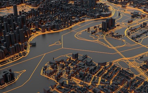
Urban development today is no longer based on assumptions or rough layouts. Every successful development project begins with accurate, well-prepared geographical map drawings. These drawings form the technical foundation for planning, approvals, design coordination, and construction execution. Without precise geographical mapping, even well-funded projects face delays, legal complications, and costly design revisions. Geographical map drawings provide a clear visual and technical representation of land features, boundaries, elevations, access routes, and surrounding infrastructure. They allow planners, architects, engineers, and authorities to understand the physical characteristics of a site before any design or construction work begins. In rapidly developing regions such as the UAE, accurate mapping is essential to ensure compliance with zoning regulations, infrastructure alignment, and sustainable urban growth. Role of Geographical Maps in Urban Planning Urban planning relies heavily on spatial accuracy. Geographical map drawings help planners assess how land can be utilized efficiently while considering roads, utilities, public spaces, and environmental constraints. These maps support decision-making related to land subdivision, road connectivity, drainage planning, and public service placement. Accurate geographical maps also help avoid conflicts between neighboring plots, reduce land disputes, and ensure that developments align with approved master plans. When planners have access to reliable mapping data, they can design cities that function efficiently and grow sustainably over time. Supporting Regulatory Approvals and Compliance One of the most critical uses of geographical map drawings is in regulatory approval processes. Municipal authorities, planning departments, and infrastructure agencies require precise maps to evaluate development proposals. These drawings must clearly show land boundaries, coordinates, access points, setbacks, and surrounding developments. Inaccurate or incomplete geographical maps often result in application rejections, repeated revisions, and approval delays. Professionally prepared drawings ensure that submissions meet regulatory standards and reduce the risk of non-compliance. This not only saves time but also improves the credibility of the developer or consultant submitting the project. Integration with Engineering and Infrastructure Design Geographical map drawings play a vital role in engineering coordination. Infrastructure systems such as roads, drainage networks, water supply, and electrical services must be designed in alignment with actual site conditions. Accurate maps allow engineers to plan these systems efficiently while minimizing clashes and redesigns. Elevation data, contour lines, and terrain analysis included in mapping drawings help engineers manage water flow, avoid flood risks, and design stable foundations. Without accurate geographical information, engineering designs are based on assumptions that can lead to structural or functional issues during construction. Enhancing Cost Control and Risk Management Errors in early-stage mapping often lead to major cost overruns later in the project lifecycle. Incorrect land measurements, missing site features, or outdated data can result in redesigns, construction delays, and material wastage. Accurate geographical map drawings reduce these risks by providing reliable data from the beginning. When project teams work from precise maps, they can plan construction activities more efficiently, allocate resources correctly, and avoid unexpected site challenges. This improves overall cost control and reduces project uncertainty. Supporting Sustainable and Smart City Development Modern urban development increasingly focuses on sustainability and smart infrastructure. Geographical mapping supports environmental analysis, land-use optimization, and integration of green spaces. It allows planners to assess environmental impact, protect natural features, and design developments that respect ecological balance. Accurate mapping is also essential for smart city initiatives that rely on digital data integration. Geographical maps serve as the base layer for GIS systems, smart infrastructure planning, and future urban expansion strategies. Conclusion Accurate geographical map drawings are not just technical documents; they are strategic tools that shape the success of urban development projects. From planning and approvals to engineering coordination and sustainability, these drawings influence every stage of development. Investing in professional geographical mapping ensures accuracy, compliance, efficiency, and long-term project success. In modern urban environments, where precision and accountability are critical, high-quality geographical map drawings form the backbone of responsible and future-ready development.